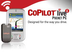
 Some time back I received a GPS (Global Positioning System) for my Phone. GPS uses signals from satellites to pinpoint your exact location. By connecting this signal to mapping software you can be given directions to any destination within the range of your maps. The mapping software I have is Co-Pilot and I have maps for the whole of Australia.
 It sure beats having the street directory open on your lap while you're driving. Some other cool features are that it can tell you how fast you're going, your elevation above sea level, the direction you're heading and an approximate arrival time at your destination. You can set your destination to a street address, point of interest, landmark or a presaved destination.
It can also warn you of red light or fixed speed cameras or tell you how far to the next petrol station.

1 comment:
Whatever will they think of next? I get by with my ten year old Melways and whereis.com.au, but still manage to take wrong turns pretty much every time I go somewhere unfamiliar.
Post a Comment